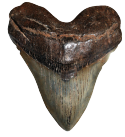
Simply the Best In Blackwater Diving
COOPER RIVER DIVE CHARTERS
Historic Resources of the Cooper River, ca. 1670-ca. 1950
United States Department of the Interior
National Park Service
National Register of Historic Places
Historic Resources of the Cooper River, ca. 1670-ca. 1950
United States Department of the Interior
National Park Service
National Register of Historic Places
Simply the Best In Blackwater Diving
Copyright 2020
Cooper River Dive Charters
260 Amy Drive
Goose Creek, SC 29445
843-296-3344
Augustine T. Smythe Stoney's Map
Cooper River Plantations as they were in 1842